

When discussions about South Africa’s townships arise, the focus is often predictable: unemployment, poverty, crime, service delivery protests, or the promise of the “township economy”. Yet there is another, quieter feature that rarely enters public debate. It is not what is present in townships, but what is absent.
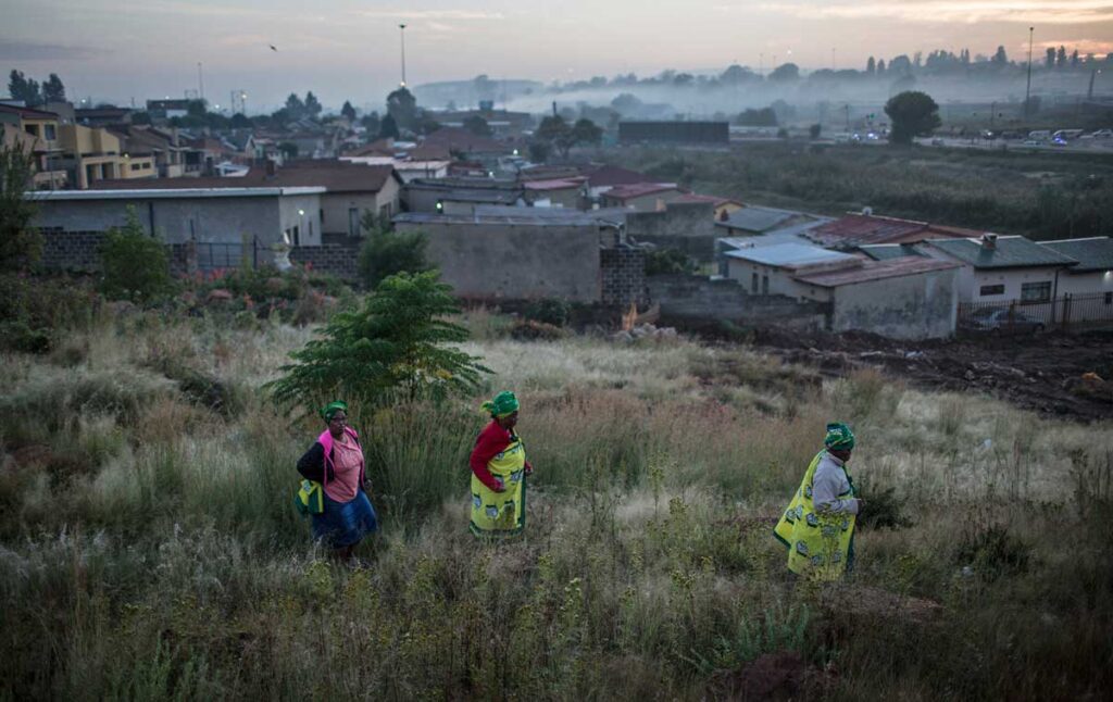
Walk through many townships and you will notice the quiet absence or limited presence of trees lining the streets, the limited presence of birds and greenery, and the scarcity of shaded parks or communal green spaces. These absences might appear incidental or simply the result of poverty or municipal neglect. But they are not merely aesthetic shortcomings. They are part of a deeper story about how space was historically designed and how that design continues to shape life today.
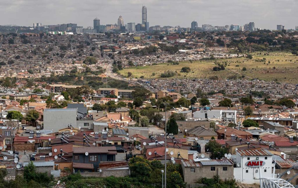
Alexandra township with the Sandton cityscape in the background. Photo: Emmanuel Croset / AFP
Townships in South Africa were not organic settlements that emerged alongside the natural growth of cities. They were deliberately engineered through apartheid’s spatial planning system. Under the system formalised by apartheid through policies like the Group Areas Act and the Natives (Urban Areas) Act, black South Africans were relocated to peripheral settlements designed primarily to control, monitor, and contain labour rather than to nurture communities. Townships were therefore designed with very different priorities from suburban areas:
- Minimal investment in public space
- Limited vegetation and environmental planning
- Dense housing layouts designed for surveillance
- Distance from economic centres
Other laws that affected spatial development patterns and denied land and citizenship rights to blacks in urban areas include the 1913 Natives Land Act, which prevented black people from owning land outside rural reserves in the former native African states. The 1926 Colour Bar Act prevented blacks from practising skilled trades, essentially protecting skilled white workers from wage competition. The 1918 Natives in Urban Areas Bill was designed to force blacks into outlying townships, and the 1923 Urban Areas Act introduced the idea of residential segregation of different racial groups.
The geography of townships therefore reflected a particular political logic. They were deliberately located far away from city centres, often near industrial zones or undesirable land, far from central business districts and suburban amenities. The goal was to ensure that black South Africans remained economically useful but spatially excluded. Townships became reservoirs of cheap labour rather than spaces of development.
This geography produced a paradox that continues to shape South African cities today: Black South Africans were essential to the economy as labour yet were excluded from the spaces where the economy operated.
Additionally, townships were planned with layouts that made monitoring movement easier. These layouts include few entry and exit routes, grid patterns that facilitated policing, and buffer zones separating them from white suburbs. In essence, space itself became a technology of governance. The legacy of this design still shapes mobility patterns today.
Yet perhaps the most insidious feature of this spatial system is the form of violence it produced. Not the visible violence of police repression or forced removals, but a quieter, almost invisible violence embedded in the landscape itself.
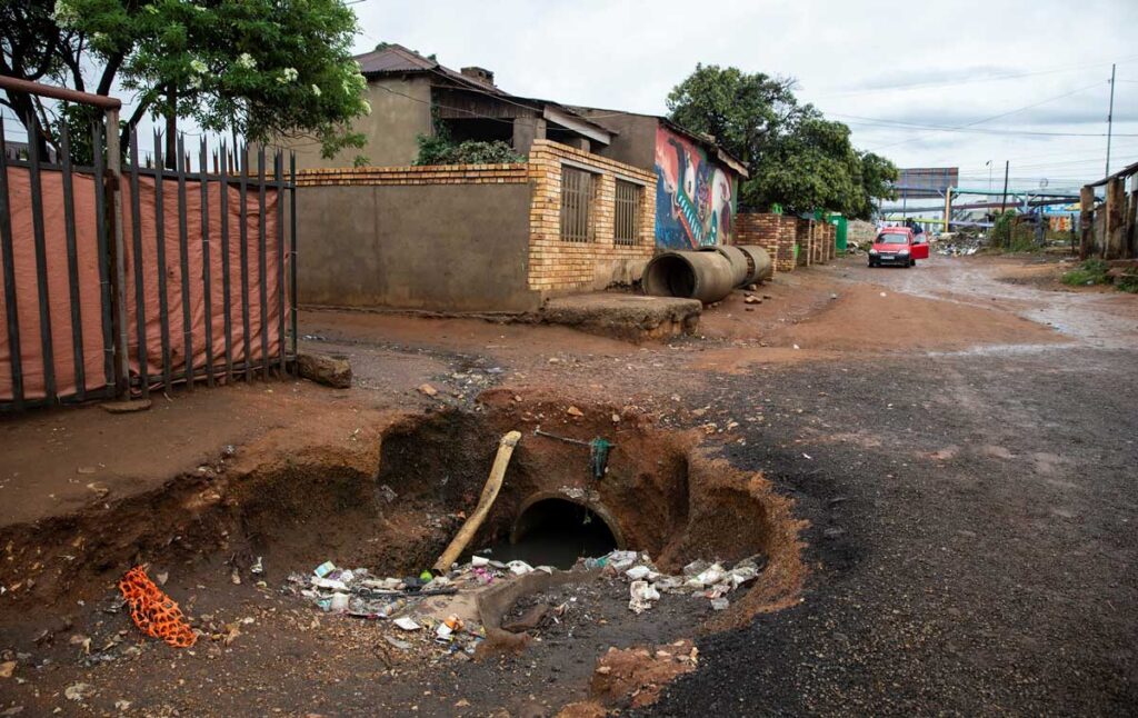
The absence of trees, green spaces, and environmental amenities communicates something profound about whose lives are considered worthy of dignity, comfort, and beauty. Suburbs were designed with leafy streets, parks, and recreational spaces that fostered community life and environmental wellbeing. Townships, by contrast, were built with minimal attention to such considerations.
This ecological inequality has consequences that extend beyond symbolism. Research in urban planning and public health shows that access to green spaces improves mental health, enhances social cohesion, and reduces heat in dense settlements. The lack of these features reinforces both psychological and material marginalisation.
The spatial legacy of apartheid continues to complicate South Africa’s developmental ambitions. Municipal planning frameworks such as the National Development Plan (NDP) seek to promote inclusive growth and address inequality. Yet the structural geography of townships makes many of these goals difficult to achieve.
Consider the question of efficiency in urban life. In many suburban areas, essential services such as shopping centres, schools, public transport and medical facilities are in close proximity. This spatial efficiency saves residents time and money and allows them to participate more easily in economic life. For many township residents, however, accessing these same services requires travelling distances beyond their community. Commuting consumes both time and income, placing an additional burden on households that are already economically constrained. In effect, geography imposes a form of spatial taxation in which people pay more simply because of where they live.
This spatial taxation is not abstract; it is measurable in the everyday costs borne by poorer households. Lower-income households are highly dependent on public transport. The 1996 White Paper on National Transport Policy envisioned that household expenditure on public transport should be limited to 10% of their household income. However, the average household spends about 20% on transport. For a significant share of workers, particularly in townships and rural areas, transport costs consume an even larger portion of monthly income.
These figures reflect more than inefficiencies in the transport system; they reveal how deeply spatial inequality is etched into the landscape. The contrast is stark. In affluent suburbs, proximity enables convenience; workplaces, schools, and services are often a short drive away. In townships, distance defines daily life. Time and income are spent not on opportunity, but on reaching it.
This has significant implications for development. Conversations about the township economy often emphasise entrepreneurship, community resilience and local business development. While these are important, they risk overlooking the structural constraints imposed by spatial design.
The persistence of these inequalities raises deeper questions about what development means and how it should be measured. Too often, development is framed in terms of economic growth, infrastructure delivery, or service provision. While these are important indicators, they do not fully capture the lived experience of inequality.
A more expansive understanding of development must consider dignity.
A Sesotho proverb captures this idea with striking clarity: Feta kgomo o tshware motho, which directly translates as “go past the cow and catch the human being”. This is an ethical maxim in the African philosophy of Ubuntu. The meaning of the saying is, if you are faced with the dilemma of making a decisive choice between the protection of wealth (cow) and the preservation of human life, then the latter should never be in doubt.
Apartheid’s spatial planning inverted this principle by prioritising economic productivity and political control over human wellbeing. Democratic South Africa now faces the challenge of restoring that balance. This means thinking more intentionally about the role of space in shaping dignity and opportunity. Urban greening initiatives, better integration between townships and economic hubs, improved transport systems, and mixed-use development could all help to reshape the spatial inequalities that persist today.
The decentralisation of urban governance and metropolitan governments was established as a direct response to the deep history of racially defined and fragmented local government. Central to their mandate was to address the spatial legacy of segregation, create more opportunities for the black population to access urban opportunities, and tackle the division between places of work and residence. Even with the establishment of legal provisions like the Spatial Planning and Land Management Act of 2013 and plans such as the NDP, urban governments have not managed to fundamentally change the spatial, economic, and social dynamics of cities and towns.
Townships are not temporary spaces. They are now permanent features of South Africa’s urban landscape. The question is not, therefore, whether they should exist, but how they can be reimagined into spaces that reflect the values of democratic society. Rethinking township development requires confronting the deeper ethical questions that underpin our understanding of development itself. Economic efficiency and infrastructure delivery are important, but they cannot be the sole measures of progress.
The quiet absence of trees and birds in many townships may seem like a small detail in the vast landscape of South Africa’s challenges. Yet these silences in the environment remind us that injustice is not only written into laws or economic statistics but is also written into the spaces where people live.

Dr Mmabatho Mongae is a Lead Data Analyst at Good Governance Africa (GGA), where she plays a key role in developing innovative, data-driven tools to improve governance and urban management across the continent. Her work includes the Governance Performance Index (GPI), a first-of-its-kind assessment of local municipal performance, and the African Cities Profiling Project, an initiative aimed at building a comprehensive information bank to assist cities in enhancing service delivery for both citizens and enterprises. She has a PhD in International Relations from the University of the Witwatersrand, and is a research fellow at the Centre for Africa China Studies.